Provided by, The Greek Catholic Archbishop of Presov
The center of the village is 325 meters above sea level. The surrounding area is between 300-670 meters above sea level. ANDREJOVÁ is situated in LOW BESKYDY in the valley of Andrejovský creek. The area is surrounded by gently rugged hills, mostly in the southeastern part with steep hillsides. The trees in the area are beech, birch, and pine.
The village began in the later part of the 14-century on the buying rights of the landlords of Smilno. First mentioned in 1355, it belonged to Makovica landlords. In 1427 the village had 24 houses. At the end of the 15th century the village was devastated by the Polish army. In the 17th century landlords of the village established fish farms here. The inhabitants were involved in farming as well as forest work. In 1711 the village was depopulated. In 1787 it had 80 houses and 451 inhabitants and in 1828 the village had 84 houses and 621 inhabitants. During the first republic many inhabitants emigrated. A high number of present-day residents now work in different industries in Bardejov and Košice with others still involved in farming. The houses in the village are situated on both sides of the creek. Several log houses are preserved from 19th century with straw roofs. Men of the village during the 19th century were involved in house to house businesses selling basketworks.
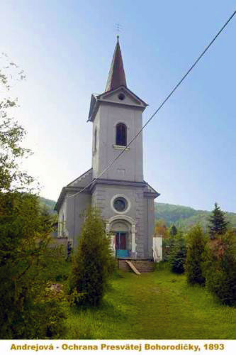
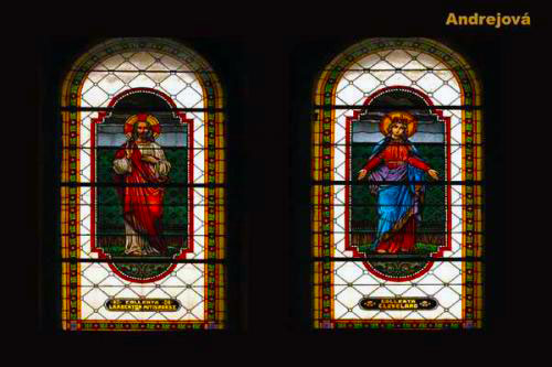
Care of the Mother of God Greek Catholic Church is from 1893 and the Chapel is from 1925 with furnishings from the older wooden church.
Village Statistics
Over time there have been varying names for the village:
1355 Andras Vagasa, 1414 Endreuagasa, 1618 Andreowa, 1786 Andrasowce, 1808 Andrejova; Hungarian: Endre Vagasa, Andrejova, Andrejovsky, Andrejovcan, -ka.
Administrative Structure:
Šaris County; district Bardejov, region Prešov until 1960; district Bardejov, Eastern Slovakia Region.
Population Statistics:
Population in years: 1869-360, 1880-386, 1890-389, 1900-379, 1910-401, 1921-409, 1930-427, 1940-456, 1948-390, 1961-421, and 1970-405.
Acreage:
1166HA is the size of the village. HA is short for Hektar. 1 Hektar is 2.471 acres.
The following photos provided by, The Greek Catholic Archbishop of Presov
Care of the Mother of God Greek Catholic Church
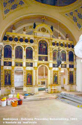
Iconastasis
Stained Glass Church Windows
Roadside Chapel

|