Courtesy of Steven Osifchin
Transcribed by Steven M. Osifchin
Transcribed by Steven M. Osifchin
Transcribed by Steven M. Osifchin
Over time there have been varying names for the village:
1427 Ayathuagasa, 1773 Hajtuska, Hajtuvka, 1920 Hajtuvky, 1927 Hajtovka; Hungarian: Hajtuvka, Hajtoka; hajtovsky, Hajtovcan,-ka;
County and Region:
Saris County; district Stara Lubovna, region Presov from 1960; district Presov, and from 1968 district Stara Lubovna, Eastern Slovakia Region.
The names of the parts of surrounding areas:
Becirok, Cigonivka.
The population has been in a steady decline over the years:
1869-313, 1880-288, 1890-281, 1900-225, 1910-207, 1921-196, 1930-199, 1940-208, 1948-198, 1961-175, 1970-160.
Village size:
305 HA is the size of the village. HA is short for Hektar. 1 Hektar is 2.471 acres
Background:
The center of the village is 525 meters above the sea level. Surrounding area is between 490-744 meters above the sea level. HAJTOVKA is situated on the south slope of the middle part of Lubovna highlands. The area is mostly highlands, strongly undulated surface of the area is made of cliffs zone. Most of the area was clear cut long time ago and the pine forest is only on the steep slopes of the valleys. Soils are mostly brown.
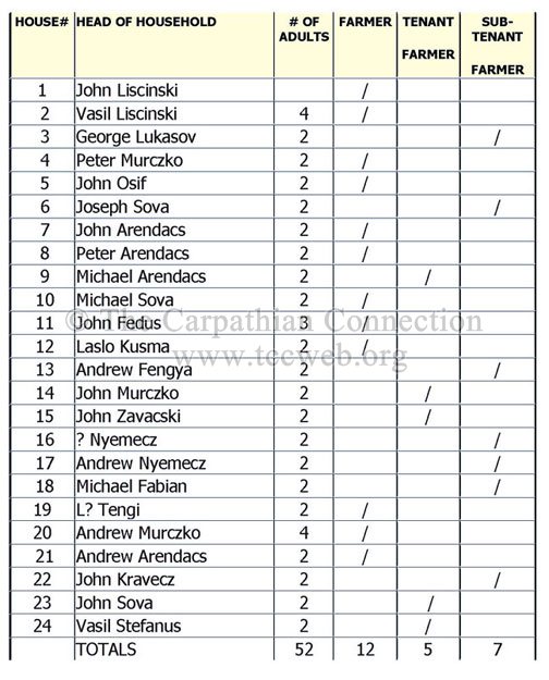
The village was incorporated under purchasing charter in the first half of 14th century. It is mentioned in 1427. It belonged to the PLAVEC holdings nearby with the castle. In 1787 it had 27 houses and 196 inhabitants, in 1828 it had 35 houses and 271 inhabitants. They were farmers. Even after 1918 the village kept its farming character. Farmers co-op was established in the village in 1949. Most of the people work in farming with some working in Stara Lubovna.
Church:
The Greek Catholic Church of the Holy Mother Church of the Nativity was erected in 1872.
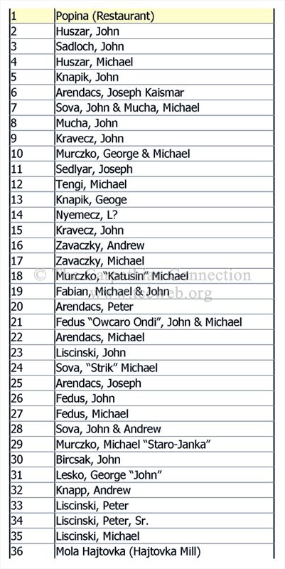
The following is a complete list of all legible gravestones found in the Hajtovka Cemetery. The upper portion of the cemetery is mostly grass but appears to have once been the old section of the graveyard. The cemetery is to the immediate left of the Greek Catholic Church. This list was compiled by Steven M. Osifchin in May 2004.
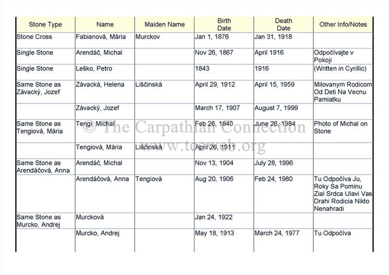
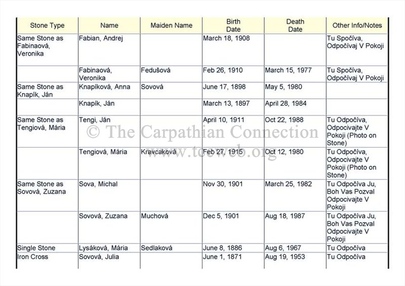
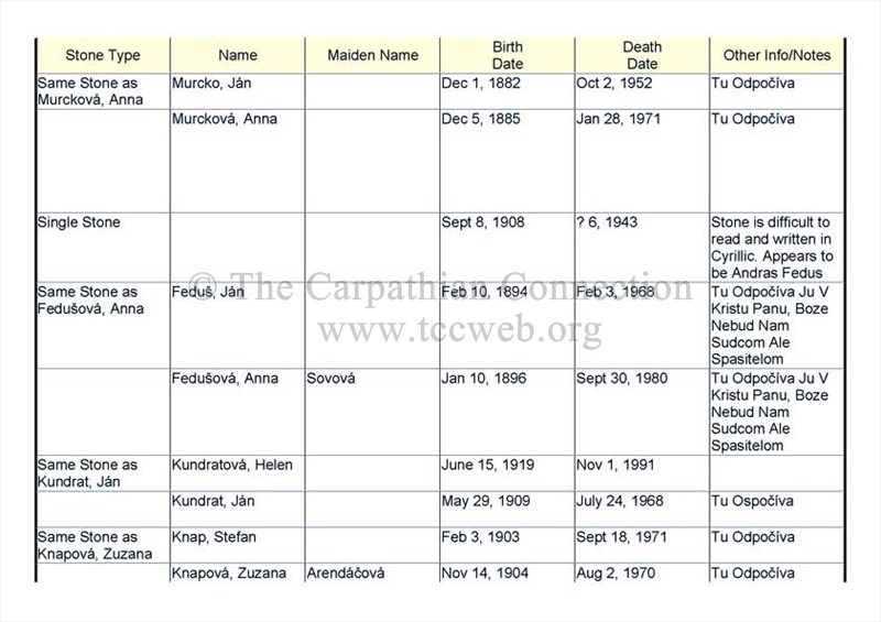
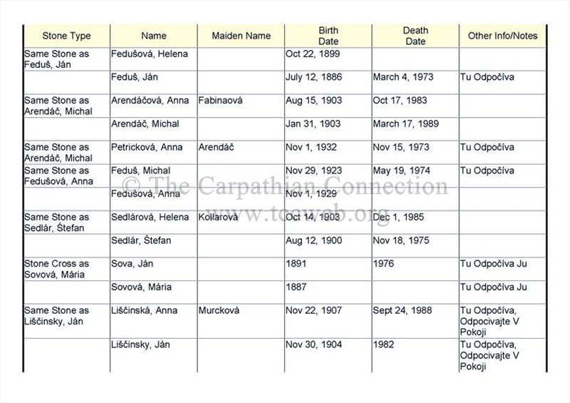
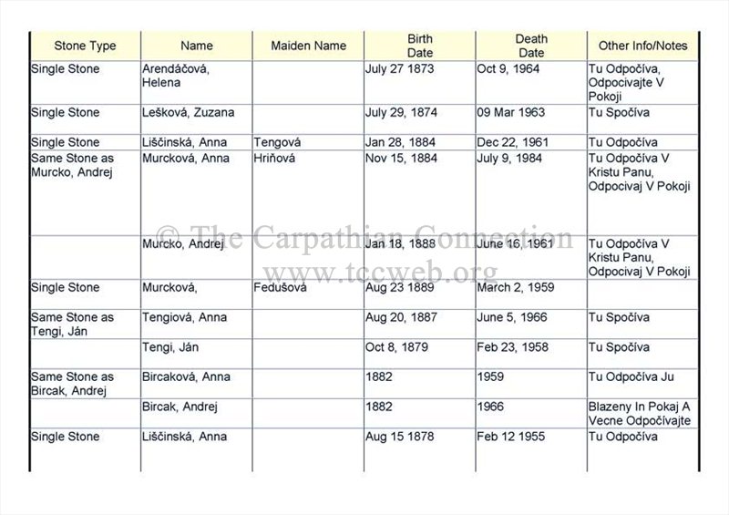
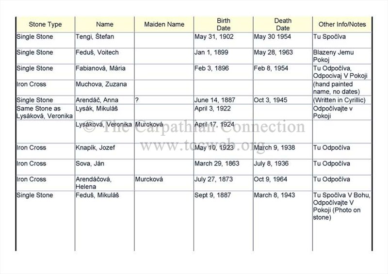
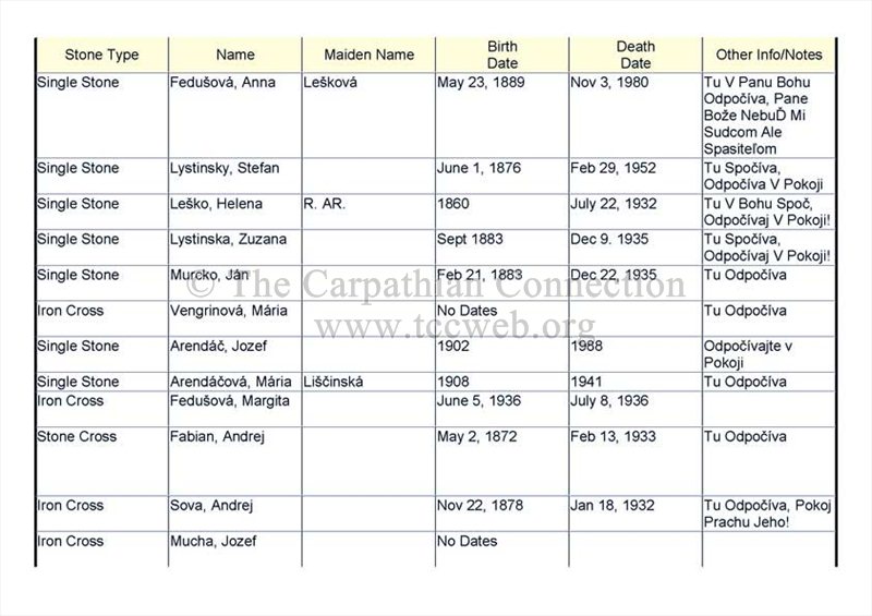

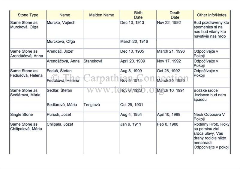
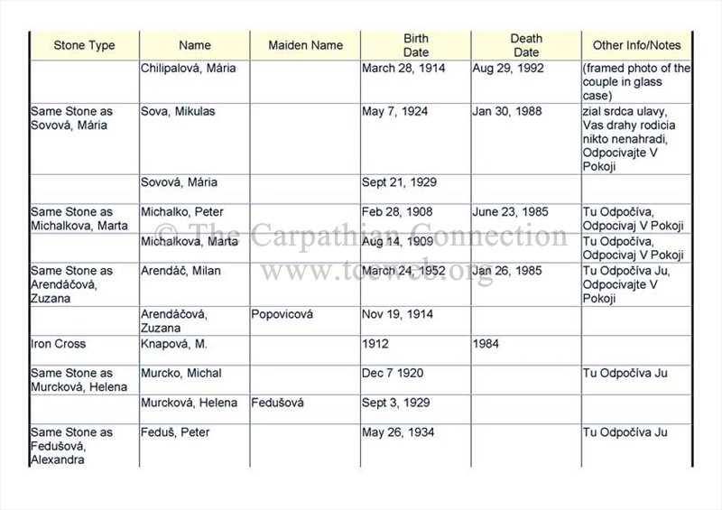
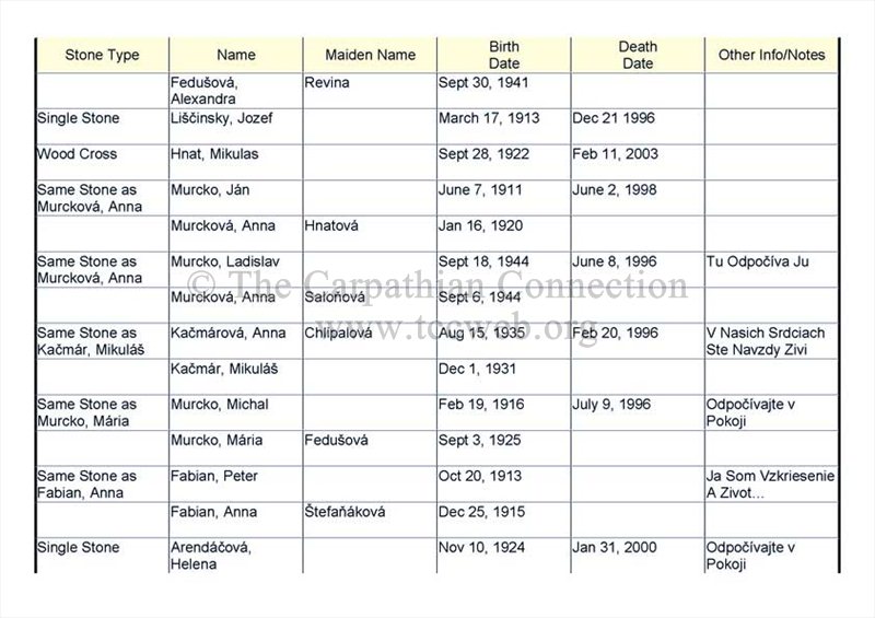
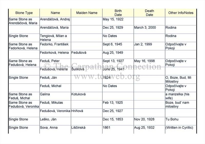
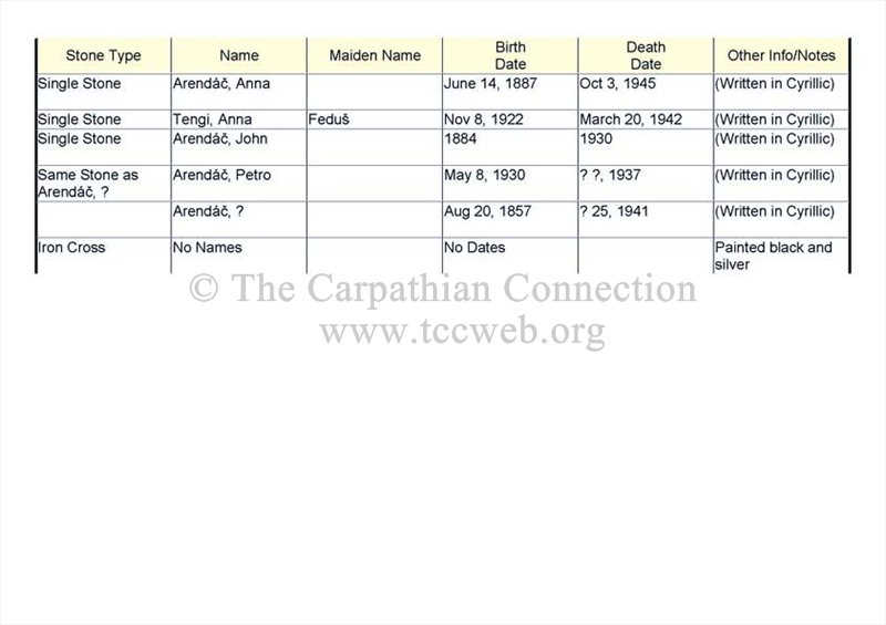
Note: This is not a full transcription of the records. Several items were not transcribed. (Transcribed by Steven Osifchin)
(Transcribed by Steven M. Osifchin)