The center of the village is 545 meters above the sea level. The range of the surrounding area of the village is between 501 and 824 meters above the sea level. KRÁSNA LÚKA is situated in the north eastern pert of Levoča’s mountains in the valley of Kučmanovský creek. Most of the surounder area has been deforested. The soils are mostly brown.
The village is first mentioned in 1329 as a parish, that began on buyer’s right. It belonged to landlords of Torysa. The inhabitants were farmers and breeders of livestock. In 1787 there were 59 houses and 397 inhabitants. In 1828 there were 60 houses and 474 inhabitants. After 1918 most of the inhabitants stayed in farming and in breeding livestock. Today, part of the inhabitant work at factories in Poprad, Lipany and Košice.
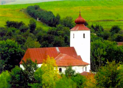
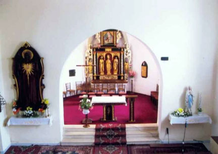
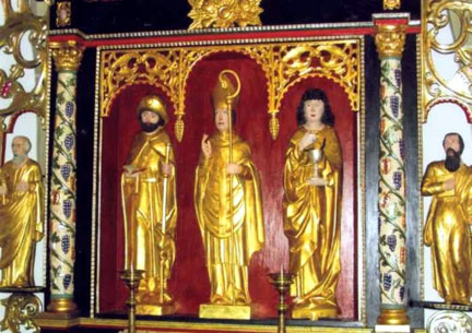
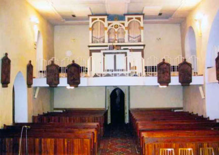
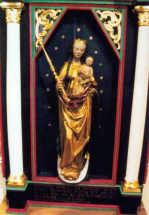
The church of St. Martin is in early gothic style from 1295 and remodeled in second half of the 15th century. The church was remodeled in the Baroque style in 1722 and again remodeled again in 1854. In the interior are architectual details such as the main altar from 1672-74 with late gothic carvings believed to be from the workshop of Master Paul from Levoča. There is a wooden statute of the Madonna from around 1490 from the circle of J. Weiss from Prešov( the “Madonna from Šenviz”, dated 1580). This church Madonna is now in the Slovak National Museum in Martin.
Today, one of the finest Slovak Folk Singers, Monika Kandracova, resides in this village.
Village Statistics
These are the different names of the village over time:
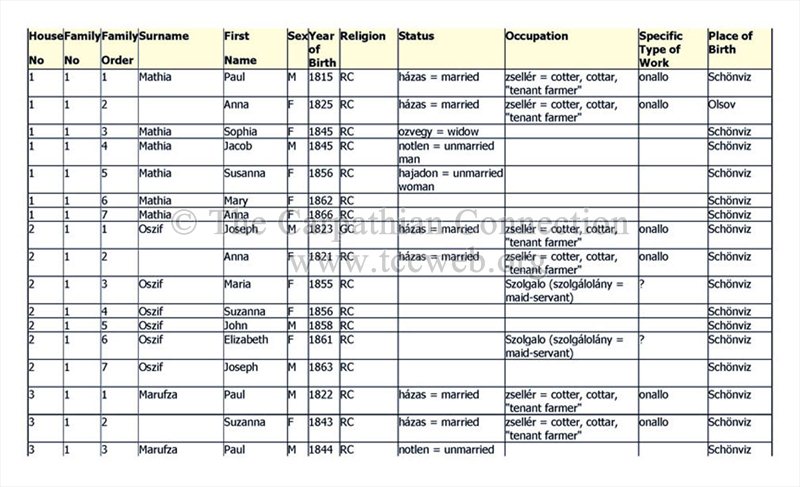
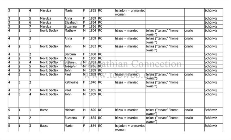
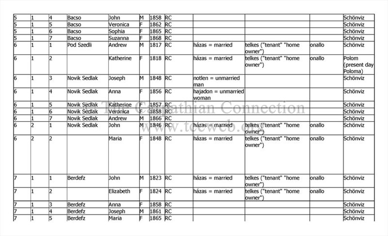
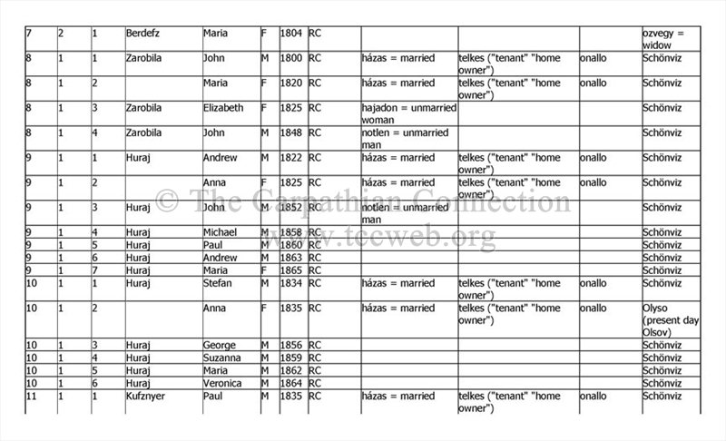
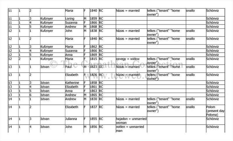
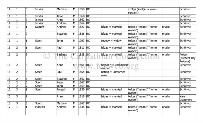
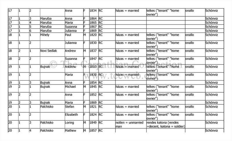
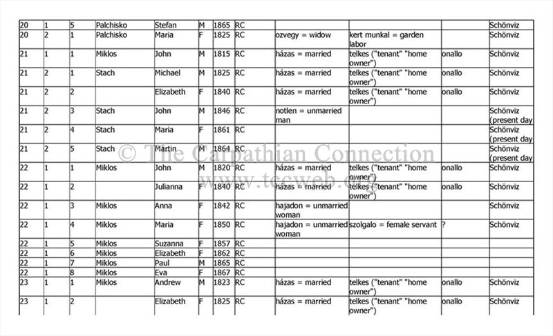
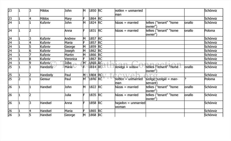
The following is an extract of the 1869 Hungarian Census Data for the village of Krasna Luka.All names and dates have been recorded as I have interpreted them. Unlike other 1869 census records that I have researched the census for Krasna Lukadid not list the maiden name of the wife. The complete census can be found online at familysearch.org